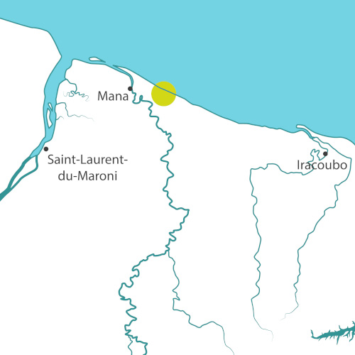
In French Guiana, large mud banks move along the coast, from east to west. When they are present, they dissipate the swell, protect the coast from erosion, and mangroves can develop. When they are absent, the waves break on the beaches, the erosion is stronger. The Guyanese coast is therefore highly dynamic and unsettled.
Until the early 1980s, the coast of Mana was made up of a mosaic of wetlands and mangroves on the shoreline. This area, known as "Savane Sarcelles", was then converted into a large rice-growing polder of 5,000 hectares (12,350 acres) which led to the creation of new open wetland habitats that prove to be very rich in biodiversity.
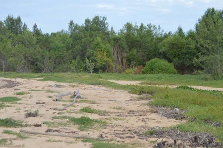
Between 2000 and 2016, in the absence of a mud bank, the coast retreated by 1.5 kilometers.
In addition to these erosion issues, other constraints and difficulties led to the end of the rice development project on the site: regulatory modifications of exploitation, changes of owners and various economic difficulties.
This agricultural abandonment resulted in the closure of wetland habitats, less rich in biodiversity.
The Mana polder is known for its remarkable ornithological richness, unique in French Guiana. Each year, hundreds of thousands of birds of more than 200 different species gather there. The migratory wading birds represent the largest numbers, and therefore, conserving the Mana polder is an issue of global importance.
Aware of these issues, the Conservatoire is working on land management to protect this area and maintain its richness by setting up a site project based on a diversified agricultural use, the opening to visitors and the development of ecotourism based on birdwatching.
Project for the site
The adapto program has launched several studies, some of which are essential for the formulation of the site management plan. An example is the BRGM study to model the coastline projection in the medium term. It will define the limit to be set between on the one hand the natural area where an adaptive coastal management will be tested and on the other hand the agricultural area, and thus implement an adapted management strategy.
The maintenance of open areas by the presence of cattle coupled with the restoration of the hydraulic network will contribute to the preservation of wetlands favourable to the avifauna. The ornithological richness of the rice fields gives them a strong ecotourism potential. Birdwatching could eventually become the main activity in the former rice fields.
Site chronicle
2018
- 5th July: Land purchase of 1,500 hectares (3,700 acres).
- 3rd September: Right of first refusal on a surface of 2,200 hectares (5,400 acres).
- 14th September: First steering committee for the management plan, a group of four consulting firms is in charge of drawing it up.
- 17th October: BRGM launches a study to model the projection of the coastline in the medium term (50 years) and the risk of submersion of the polder.
- 19th November: Launch of the landscape study in partnership with the ENSP.
- 28th November: First technical committee, BRGM explains the vulnerability of rice fields to erosion and submersion.
2019
- 11th to 16th March: EUCC-France workshop in French Guiana. Meeting between researchers, managers and elected officials to discuss the state of knowledge and coast management strategies in French Guiana. The adapto project was presented along with the results of the landscape study.
- 13th to 17th May: Study trip to Camargue, the stakeholders of the Mana site and the elected officials visited sites that are facing the same issues as Savane Sarcelles.
- May: Results of the BRGM study on which the consulting firms in charge of drawing up the management plan will rely to finalize their diagnosis.
- June: Second steering committee for the management plan, the consulting firms will present the results of their diagnosis.
- Workshop on the theme of agriculture with the stakeholders of the agricultural world and the project leaders to discuss the conditions of assignment and their needs.
- July: Start of the works to create the first public access to the sea.
- September: Implementation of educational actions in the primary schools of Mana in partnership with the Nature Discovery Organization in Guiana (ADNG).
- December: Third steering committee, presentation of the project definition for the site.