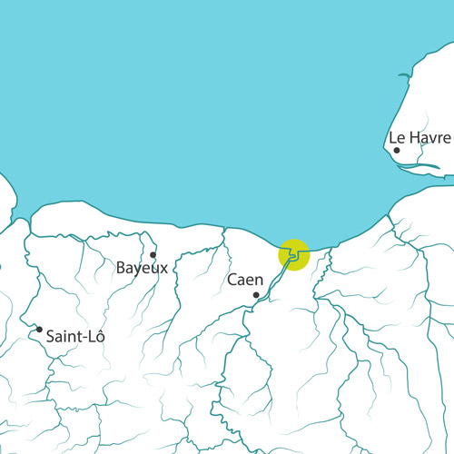
The morphology of the Orne estuary from Caen to the Channel was considerably modified following the creation of the canal in 1857. The Orne River, after Caen, splits into two straight lines which organize the area. These two streams of water, the Orne and the canal, located between two agricultural and urban plateaus, influence varied landscapes that evolve with them. The western part, along the canal, offers a port and industrial view. To the east, the river changes at the rhythm of the tides and feeds a natural landscape: the Orne Bay.
The diking of the river has led to the disappearance of schorre on most of the site. The banks of the Orne were polderised down to its mouth. The dyke of the Cagny Marsh was built in the 18th century, transforming the old meander and its salt meadows into grazed wet meadows. The Terrains François polder is the result of a recent diking (1960s) on the foreshore. Thus, downstream of the Montalivet dam (Caen), the area of lateral expansion of habitats and floods exists only on about 1/5th of the whole river bank.
In 2011, the dyke of the Cagny Marsh broke down, causing a flood on the low lands. During spring tides, the sea occasionally overflows the dyke, and the cycle path at the top of the structure is periodically closed. It is necessary to think about its future and more importantly about the land behind.
Today, the elements of knowledge available show that the conservation of the polders is not the only way to consider the future of this site. Indeed, recreating salt meadows in the sector of the Terrains François is advantageous regarding economy, biodiversity protection and landscape.
Concerning the Cagny Marsh, the LiCCo (Living with a Changing Coast) program, carried out from 2011 to 2014, allowed a better understanding of the evolution of the Orne Estuary. All local stakeholders reflected collectively on what could be the coastline of tomorrow. The adaptation of this estuary in the context of global warming and sea level rise is therefore based on:
- a vision for 2050: the development of a large estuarine territory, wider, deeper for greater climate resilience;
- a tendency towards 2025: the implementation of concrete and localized projects of lateral disconnection and coastline mobility.
Along the Orne are many canals and lacks expansion space: this raises the question of the disconnection of polders and adjacent marshes in a perspective of adaptation to climate change.
The Adapto project for the site:
In Sallenelles, the Conservatoire and the local stakeholders will design how the visitors will access the site after the rewatering of the Terrains François.
Concerning the Cagny Marsh, a process of reflection and project definition is to be started, firstly through historical and landscape approaches, then by the definition of prospective scenarios. In the scenario of a sea level rise, erosion and rising groundwater levels, the Cagny Marsh dyke would become obsolete and useless. Based on this analysis, the Conservatoire du Littoral and the Departmental Council of Calvados, manager of natural areas, are working to create an alternative cycle path.
In case of a restoration of the maritime character of the marsh, walking, cycling and fluvial paths will offer new atmospheres to the visitors. The pathways, starting from the Maison de la Nature and the estuary, contribute to maintaining its attractiveness in the heart of the bay. In parallel, a consultation should be conducted with Normandy Cabourg Pays d'Auge, the Chamber of Agriculture, the Safer, the Conservatoire du Littoral and local farmers to plan the gradual evolution of their farms to adapt to this scenario in the coming years.

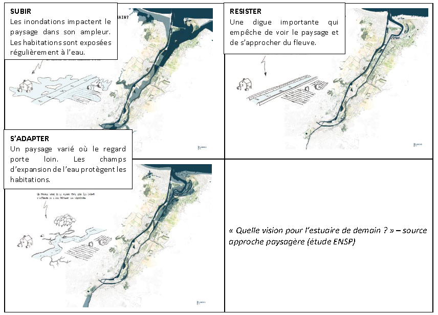
Study for 2050 – Regeneration of the mouth of the Orne Estuary : Download the file
In addition, integrating climate change makes it necessary to look beyond the mouth of the Orne Estuary (intervention area of the Conservatoire du littoral). The restoration of a maritime character to the Orne requires a well-thought-out strategy for the whole area between Caen and the Channel. Considering adaptation with different stages by 2050 requires the intervention of various stakeholders:
- The Department of Calvados (green paths, environmental sensitive areas…), the CPIE
- The City of Caen, the Urban Community Caen la Mer, the Community of Communes Normandie Cabourg Pays d’Auge and the municipalities situated downstream (GEMAPI law, urban planning documents, urban planning of the peninsula…)
- Ports Normands Associés (Port Development Strategy)
- The local offices of the government and the ministries (Hazards Prevention Plan).
Concerning the Conservatoire du littoral, three perspectives should be considered.
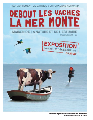
Finally, raising public awareness is an important issue and is the subject of artistic and educational actions in collaboration with the CPIE Orne to present how the area of the Orne estuary may look like in the future.
Site chronicle
2008: Inscription of the rewatering of the Terrains François in the management program of the Orne Estuary.
2010: The Terrains François project becomes a compensatory measure of the ferry terminal extension.
2011: Validation of the guidance document of the Natura 2000 site including the support to the rewatering.
2013/2014: Technical feasibility study, with biodiversity protection and risk management as the main issues.
2014: Rejection of the works by the local population and the City Council of Sallenelles.
2015: Opposition to the project at the public meeting. To establish a collaborative approach to define the development of the site becomes impossible.
2016: Survey conducted by the CPIE Vallée de l'Orne, asking the inhabitants of Sallenelles their opinion about an adaptive reconnection to the sea of the Terrains François: diagnosis of practices and uses, identification of emblematic paths, definition of expectations and compilation of development proposals concerning the access to the site.
2017: Landscape approach of the Orne Estuary Download the file+ Integration of the proposals of developments resulting from the survey of the population to maintain a visitors’ access despite the rewatering project.
22nd September 2017: Approval by the steering committee of the technical solution of scuppers and related facilities for the visitors’ access.
16th January 2017 and 9th January 2018: Validation of the Terrains François project by the City Councils of Merville-Franceville and Sallenelles.
15th June 2018: Reflection to consider alternatives to the green path on the Cagny Marsh with the Department and the Community of Communes Normandie Cabourg Pays d’Auge.
20th August 2018: Development of a program of educational actions by the CPIE Orne with 3 middle schools and creation of an exhibition.
7th September 2018: Study of the impact of sea level rise on the salt wedge around the estuary (DREAL).
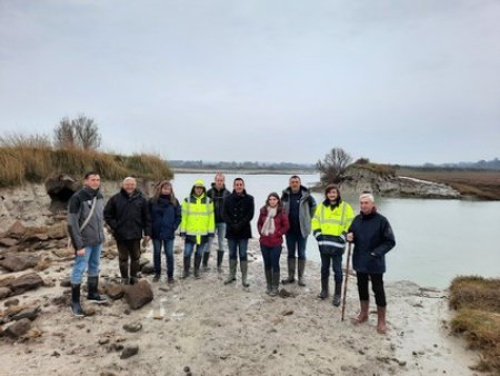
22nd October 2018: Meetings with Ports Normands Associés to integrate the adapto project in the Port Development Strategy.
15th November 2018: Return on experience of the CACTUS Life in the Gulf of the Morbihan (evolution of the landscape, adaptation of the architecture…).
20th November 2018: Presentation of the adapto method to the "Coast and Tourism" committee of the Urban Community of Caen la mer. Download the file
12th December 2018: Presentation of the adapto method to Mr Joyau, Deputy Mayor of Caen.
19th December 2018: Meeting of the Orne Estuary management committee.
7th February 2019: Presentation of the adapto method to Conseil de rivages Normandie (the Normandy board within the Conservatoire du littoral).
6th March 2019: Presentation of the adapto method to the "Environment, Sustainable Development and Waste" committee of the Urban Community of Caen la mer. Download the file
14th March 2019: Presentation of the adapto method to the "Water cycle" committee of the Urban Community of Caen la mer. Download the file