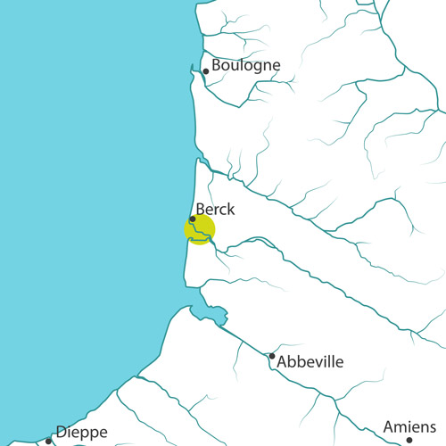
Authie Bay, the coastal border between Pas-de-Calais and Somme, is an estuary that is typical of Picardy: on one side an accreting shore (the poulier, south shore) and on the other, strongly eroding sections (the musoir, north shore).
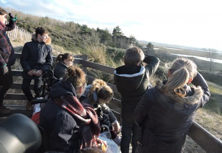
The Authie Bay is the subject of complex sedimentary exchanges and offers a wide variety of natural environments (dunes, polders, salt meadows, bocage meadows, ponds...). These complementary habitats provide a stop for migratory birds and are used for many purposes.
Between 1258 and 1862, with the accretion of the poulier (south shore), dykes were built (locally known as renclôtures) to gain farmland over the salt meadows. In contrast, the north shore experienced (and continues to experience) a strong erosion, particularly intense and visible at the Anse des Sternes, the sand dune between the Bois des Sapins and the Bec du Perroquet. Meanwhile the schorre (or salt meadow) progressed slowly while the bay filled up.
On the north shore, the erosion of the dune bar causes fear of a possible breach that would threaten to flood the lowlands behind it (see: Flood Risk Management Plan). This erosion results from the combination of different factors: the natural evolution of the poulier/musoir system under the effect of waves and wind, the deviation of the main river-bed of the Authie in its bay, and the various structures built by man over the centuries. The sea and the Authie river continuously shape the coastline.
The Authie Bay belongs to the territory of a PAPI (Flood Risk Management Program). In order to anticipate sea level rise due to climate change, different scenarios have been studied, and adaptive coastal management has been favoured:
- Point out the works that are essential to the safety of people and locate them effectively.
- Reconnect some of the polders with the estuary to better supervise the evolution of the coastline.
- Design the works by taking into account their impacts in a holistic manner so that protections built in one place do not increase erosion in another one.
The adapto project for the site:
A collective balance is to be reached between safety of goods and people, conservation of uses (hunting, agriculture, fishing), eco-tourism development and preservation of spaces.
The Conservatoire du Littoral participates in the resilient development of the bay. It gradually acquires pieces of land whose topography offers a natural protection complementary to the dyke system defined in the PAPI. The main line of the project is to make the dunes and marshes buffer areas in front of the structures. At the back of the bay, the repositioning of dykes will restore flood expansion areas. At the level of the Bois des Sapins, the creation of a dyke at the back will protect the zone from submersion in case of a breach in the dune. However, to avoid the formation of a breach, the dune bar, made firm by the planting of pines in the 1960s, must become mobile again.
The repositioning of the dykes will impact current uses of this territory (agricultural, hiking...). Therefore, meetings are held with local stakeholders to explain the consequences of the different management options on economic activities and to find solutions. A territory project is to be designed by the stakeholders regarding the new works to highlight this land-sea interface.
The purchases of land by the Conservatoire du Littoral and the works conducted by local authorities are both pictured in a handbook on landscapes and make possible to consider the creation of loops around the bay. At the Mollière (an agricultural polder area created in 1850 and purchased in 2002), the adapto project plans to increase the ecological quality of the estuary by designing resting, nesting and feeding areas for birds. An overall access plan to the bay will define the works to be undertaken in the coming years to develop eco-tourism in this preserved natural area.
Site chronicle
7th May 2015: meeting of the Scientific committee: presentation of the adapto project and recommendations concerning natural risks management in Authie Bay.
30th September 2016: Walk with elected officials to explain the works undertaken and the projects around Authie Bay through a landscape approach for a better understanding of the need to work on the entire Bay both on the seafront and backshore.
January 2018: meeting to coordinate the various projects around the Bay.
10th October 2018: PAPI BSA steering committee – presentation of the adapto project to the local stakeholders.
28th November 2018: On site meeting with the Prefect of Pas-de-Calais.
21st December 2018: Creation of a follow-up committee of Authie Bay north shore - Departmental Direction of Territories and the Sea (DDTM, leading authority), CA2BM, DREAL Risques, DREAL Nature, Conservatoire du littoral.
22nd January 2019: meeting with the Marine Nature Park, to imagine coordination between the educative marine areas and the adapto project in the field of pedagogic activity.
6th March 2019: Return on experience meeting and site visit in Normandy (Community of Communes de Coutances Mer et Bocage).
11th March 2019: meeting on the action plan of the Bay with the local stakeholders.
14th March 2019: technical committee regarding the emergency works in the Authie Bay - Departmental Direction of Territories and the Sea (DDTM, leading authority), CA2BM, DREAL Risques, DREAL Nature, Conservatoire du littoral.